01
Cloud Walk
An elevated trail within the site development, highlighting the forest's relationship with clouds, slopes and the overlook.

Sarawat juniper, Tihamah mist, and trails on the edge of the clouds. A practical guide to understand the place before you arrive — no ads, no paid recommendations.
+1,700 m
Approx. elevation above sea level
4.4 / 5
Google Maps rating provided for the project
1,230
Parking spaces per 2026 data
No ticket
General entry per Visit Saudi
Operational information can change. Verify with official sources before traveling, especially during seasons, rain, and maintenance.
Location
West of Al Bahah city
On the Sarawat highlands overlooking the Tihamah slopes.
Published hours
8:00 AM — 11:59 PM
Daily per Visit Saudi; verify before going.
Suggested duration
2 — 4 hours
Extend to half a day for a family picnic and a calm walk.
Best rhythm
Morning or after noon
Soft light and calm; fog is possible, not guaranteed.
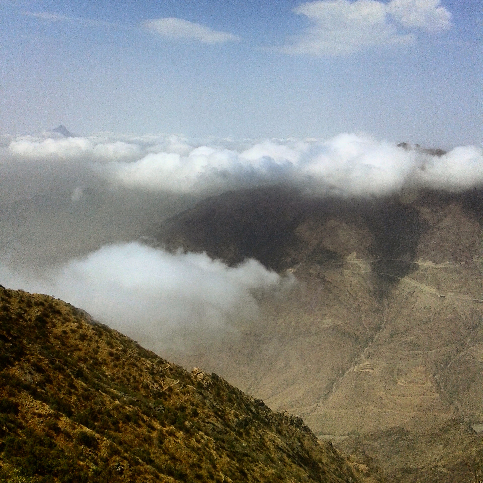
Raghadan sits on the Sarawat mountains west of Al Bahah city, at an elevation above roughly 1,700 meters. It is not just a green space; it is a visual transition between the Sarawat peaks and the slopes descending toward Tihamah, which is why low clouds and fog feel like part of the place's character when the weather allows.
Juniper trees
Among the most prominent elements of the traditional vegetation cover of the Al Bahah highlands, giving the forest its visual and ecological identity.
Wide area
Municipality data cites an area of about 482,000 m², while older tourism material suggests a wider scope; we rely on the newer municipal figure for services.

A local story of the name
Local coverage relays an oral story linking "Raghadan" to the meaning of comfortable living and abundant water and agriculture in the valley and surrounding terraces. We treat it as a circulating story, not a single documented linguistic verdict.
The historical market
The name Raghadan was also tied to a historical market known in the region for centuries and a periodic gathering point for residents and trade. This background helps understand that the site is part of a wider social geography, not an isolated photo spot apart from Al Bahah's history.
Sarawat mountains & geology
The Sarawat run as the western edge of the Arabian Peninsula, separating the highlands from the Tihamah plain. This sharp drop is what makes Raghadan a visual and climatic transition between upper peaks and slopes ending toward the sea — the secret behind its overlooks and shifting visibility between clear and foggy.
Terraced agriculture & heritage
The Al Bahah region has historically been tied to agricultural terraces and stone villages built on the slopes, reflecting an old human relationship with elevation and water. Raghadan is part of this wider cultural context, not isolated from the region's history.
Modern development
The site gained trails, seating areas, playgrounds, planted spaces, water features and viewing points, with successive expansions including "Cloud Walk", the lavender garden and outlook-prep projects.
What stays natural?
The core value remains the terrain, juniper, mountain air and the overlook. Treat the facilities as a means to reach the scene, not a replacement for it, and preserve the vegetation by staying off sensitive areas and leaving no litter.
There is no single "one spot" that sums up Raghadan. It is best to treat it as a sequence of overlooks, open spaces and trails, and choose what fits your time and walking ability.
An elevated trail within the site development, highlighting the forest's relationship with clouds, slopes and the overlook.
Part of the beautification and modern projects around the overlooks; planting density varies by season and maintenance.
A developed area with a walkway, water features, grass spaces, children's areas and photo spots.
The most constant element: the Sarawat in front of you, Tihamah below, and clouds between them when they form.


An updated weather glance to help you choose clothes and the right time to visit. The mountain setting can change visibility and the view within a few hours, so treat the forecast as a planning tool, not a guarantee.
The following figures are the latest public service data we found from local authorities in 2026. A facility's existence does not mean every unit is available at every moment, so account for maintenance and crowding.
122 restrooms mentioned in 2026 data. During crowding, use the ones closest to the main service areas.
1,230 spaces, including 42 adapted for people with disabilities. Early arrival is better at peak seasons.
14 playground areas per published data, plus open spaces and trails.
The municipality indicates a designated prayer site within the forest facilities.
Benches, grass spaces and open areas exist. Respect allowed picnic spots and do not harm plants.
Adapted parking and some developed trails exist, but the terrain is mountainous; choose paved areas per ability.
Seasonal kiosks, food carts and sales appear inside or near developed areas. Do not rely on every option at all times.
Fog and rain can lower visibility and make surfaces slippery. Sturdy shoes and a warm layer help even on some summer evenings.
Visit Saudi states that general entry to the forest does not need a ticket. We found no fixed published tariff for the park\'s parking in the official sources we reviewed, so we do not assume it is free or paid. Check the signs on arrival.
Published data indicates 1,230 spaces, including 42 adapted for people with disabilities. On summer evenings and weekend holidays, movement near gates and overlooks can slow, so make early arrival part of the plan.
Do not park on unprepared edges or in an emergency lane, especially during fog.
The critical part of reaching Raghadan is the final mountain road. Choose a means that gives you flexibility to return, and do not assume the transport you found in the city automatically reaches the forest gate.
King Saud bin Abdulaziz Airport in Al Aqeeq is Al Bahah's airport. Civil aviation places it about 46 km northeast of Al Bahah city. Practical steps: collect luggage, then either rent a car from the types available at the airport or city, or take a taxi or booked transfer toward Al Bahah, then continue west to Raghadan.
Enter coordinates 20.0220551, 41.4334279 or open the map link. Watch for fog and curves, and slow down when visibility drops or it rains. Fill the fuel tank before the highlands.
We do not rely in this guide on a fixed bus line reaching the forest gate directly without prior check. If you reach Al Bahah by intercity transport, plan the final leg in advance and check the local transport network at travel time.
A taxi or booked transfer is a practical option from the airport or Al Bahah city. Agree on a return point or check the possibility of booking a return ride, especially late at night or at peak season, as rides toward the highlands may thin out.
Navigation address
4657 Al Hakam Al ZaroOqi, 6905, Al Bahah 65731, Saudi Arabia
We do not rank lists by commission or ads, and we do not recommend specific establishments. These are only types of services worth searching around Al Bahah city per your need, with practical planning notes.
Search Al Bahah city for family restaurants, local kitchens and cafés of various types, or use seasonal kiosks and food carts if they operate inside developed areas. Do not rely on a specific option at all times, and drink enough water.
Within Al Bahah's scope there are hotels, serviced apartments, resorts and guest houses. Choose location by proximity to the city or your desire for mountain calm, not by a commercial ranking from this guide. Book early in summer peak.
It is better to buy water and basic light supplies from a supermarket or supply store within the urban area before climbing the road, especially for a long visit or with children.
Fuel stations exist on the main roads around Al Bahah. We do not confirm an EV charger inside the forest; check a maps app or charging provider before climbing if your vehicle is electric, and fill the tank before the highlands.
Seasonal kiosks, food carts and sales appear, plus restrooms, seating areas and prayer sites. Do not rely on every option at all times, as some facilities change with season and maintenance.
Clouds and fog are a major reason for Raghadan\'s fame, but they cannot be booked. Check the weather and visibility before moving, and be ready for a fully sunny scene or dense fog on the same day.
Early morning
Calm & cloud chance
A good choice for walking and photography before family areas crowd. Visibility can change fast.
After noon
Soft light & overlooks
Good for seating and walking before sunset, but it is a beloved time for visitors in season.
Summer
Milder & more crowded
Visitor movement increases because Al Bahah weather is milder than hotter regions.
The Al Bahah highlands differ from other regions by being relatively mild in summer and cool at night in winter thanks to elevation. The table is a general framework to help planning, not guaranteed precise numbers; check the official meteorology authority before travel.
| Season | Expected weather | Best for | What to bring | Safety notes |
|---|---|---|---|---|
| Winter Dec – Feb | Night cold that may approach zero on some nights, mild day, scattered possible rain and frequent morning fog. | Calm daytime walking and fog photography. | A warm layer and jacket, and shoes with good grip. | Low morning visibility, and slippery surfaces when raining. |
| Spring Mar – May | Generally mild, with possible increase in seasonal rain and greener vegetation. | Family picnics and nature photography after rain. | Layered clothes, and light rain backup. | Avoid valley courses during heavy rain. |
| Summer Jun – Aug | Much milder than hotter regions; mild day and refreshing night, with peak visitor crowding. | Escape the plain\'s heat, and evening seating. | Light summer clothes, and a hat for midday sun. | Crowding at gates and overlooks; come early. |
| Autumn Sep – Nov | General mildness and calm after summer peak, with chances of morning fog and clear overlooks. | Photography and long visits without peak crowding. | A light layer for evening, and enough water. | Visibility changes fast as low clouds form. |
A general environmental glimpse to help understand why the place stands out, not guaranteed precise data. Check the official meteorology authority before relying on any number.
Raghadan lies on the Sarawat mountains at an elevation above 1,700 meters, making its summer milder than the neighboring plain and its night cooler. These heights are within the range that sees low clouds and fog forming over the slopes, a recurring rather than a guaranteed seasonal feature. For precise numbers check the National Center for Meteorology.
Slopes turn into temporary water courses when it rains, and sudden flow can occur in nearby valleys. Do not approach water paths or pools during storms, and do not cross a valley whose flow is unknown. These are general safety guidelines, not a substitute for Civil Defense instructions.
Juniper is among the most prominent elements of the natural vegetation of the Al Bahah highlands, giving the forest its visual and ecological identity. The site is surrounded by shrub and grass species of Mediterranean tendency affected by elevation and local humidity.
The forest provides habitat for birds, invertebrates and small creatures linked to the tree cover. Specialized scientific monitoring remains limited; we therefore describe general patterns and do not assume specific species without a documented source.
Three routes oriented by the nature of the group and its rhythm: families with children, nature photographers, and seniors or visitors with limited mobility.
Families with children
Nature photographers
Seniors / limited mobility
Scientific information is more useful when paired with behavior that protects the natural site for coming generations.
Walking within prepared trails helps protect vegetation and reduce soil erosion on slopes.
Take back what you brought, and leave no food waste or bottles; keeping clean is a shared responsibility.
Avoid feeding birds or other creatures, as it disrupts the natural balance and disturbs other visitors.
Respect field signs and Civil Defense instructions, and do not approach unprotected edges during fog or rain.
These are general, non-commercial landmarks that help build context for the region. We do not give a "best" ranking, but suggest different types of experience.
A social and heritage background tied to the name Raghadan and the region's weekly trade history.
Open spaces, trails and gardens within Al Bahah city for a complementary urban green experience.
A cultural option to understand the region's history, archaeology and environments; check visit hours before going.
A known heritage destination in Al Bahah region combining stone architecture and agricultural scenery; needs time separate from Raghadan.
The forest coordinates used here are taken from the provided map link: 20.0220551, 41.4334279.
Open Google MapsAnswers are formulated from available public data, separating what is relatively fixed from operational information to verify before travel.
Visit Saudi ("Roh Al Saudi") states that general entry to the forest does not require a ticket. Some seasonal events or optional commercial activities and services may carry separate fees, so check the official announcement when an event is running.
Visit Saudi lists daily hours from 8:00 AM to 11:59 PM. Operations can change by season, weather, or maintenance, so it is best to verify via official channels before traveling.
Yes. Data from the Al Bahah municipality and the Saudi Press Agency point to green spaces, playgrounds, trails, seating and public services. Direct supervision of children remains essential because of the mountainous terrain, edges and slopes.
According to 2026 published data, the forest has 122 restrooms and 1,230 vehicle parking spaces, including 42 spaces adapted for people with disabilities. Availability of some facilities may change temporarily due to maintenance or crowding.
Early morning suits the calm atmosphere and a chance of cloud formation, while afternoon until before sunset is good for the overlooks. Summer is busier because Al Bahah weather is mild, whereas rain and fog call for more careful driving and walking.
For sightseeing and relaxed walking, plan usually two to four hours. A family or picnic visit can extend to half a day, while a shorter stop is enough for those who only want the view and photos.
Do not assume a fixed bus line goes directly to the forest gate without checking first. You can reach Al Bahah city by various transport, then complete the final leg by car or taxi depending on the service available at travel time.
No. Low clouds and fog are famous features of the Raghadan scenery, but they are weather phenomena that shift hour to hour. Do not build your plan on a guaranteed appearance.
There are designated disabled parking bays and some developed, paved paths and services, but the forest is mountainous with elevation changes. Check the intended trail on arrival and prefer paved areas if mobility is limited.
If two figures differ between materials, we use the newer or most direct one and explain the choice rather than hide the difference.
Fog, weather and seasonal events are not guaranteed services. We present them as probabilities, not a fixed appointment.
We mention only categories of services: restaurant, café, hotel, store, fuel or charging; we do not rank companies or take commissions.
Hours, fees and availability can change. Use this guide for planning, then verify with the official authority before deciding to travel.
Photographs are hosted from Wikimedia Commons and their rights remain with their photographers and license holders. The Raghadan entrance photo is by Yasser Bakhsh under Creative Commons Attribution-ShareAlike 4.0, the welcome sign photo is by Colville under public domain dedication, and the Al Bahah area photos are by Majid Al Adwani under Creative Commons Attribution-ShareAlike 3.0.